Scamp (13' Travel Trailer) Camping
Dispersed Camping
Platoro Reservoir - Colorado
ouachitamaps.com South San Juan Wilderness, Colorado

freecampsites.net
freecampsites.net NW Poncha Springs BLM
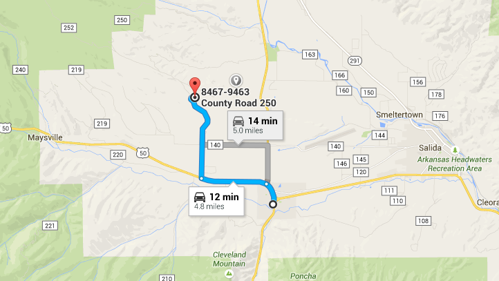
- maps.google.com-NW Poncha Springs BLM
- Poncha Springs, Colorado
- GPS: 38.554325, -106.116013
- Public - Bureau of Land Managment (Unofficial)
The road in is Dirt and 3 miles from a paved road. NW Poncha Springs BLM is open Summer. There are 16-29 campsites at this location and the maximum RV length is any. You may stay 14 nights at NW Poncha Springs BLM.
One of my personal favorite free camping locations. Somewhat remote, not bad. Able to get an RV in there easily, road is in good condition. Can get a little dusty from cars passing the area. People tend to mind their own business. No bathrooms, bring a groover. No water, bring your own. Quite possible cows may pass through your camp at night, so don’t freak out. BTW, there bears here also. So if you hear something moving around, tell yourself it’s a cow and go back to sleep. LOL
freecampsites.net Weston, Colorado to Purgatoire Campground
- Near Weston, Colorado
- before Purgatoire Campground
- GPS: 37.244609, -105.100963
- maps.google.com Weston, Colorado to Purgatoire Campground
fs.usda.gov Purgatoire Campground
29 miles southwest of La Veta, CO, in the San Isabel National Forest, San Carlos Ranger District. Go south on Highway 12 for 24 miles, and turn right (west) on County Road 34 (also listed as F.S. RD 34, CR 34.5, or North Fork Road & turns into Forest Service Road 411). 37.244931, -105.100946
This site is one of several free, camping-allowed pull-offs along the road, at the end of which is the Purgatoire Campground (a pay campground $17/night). The dirt road is rough, rocky and rutted in some spots, but mostly in pretty good shape- I made it in my car.
There’s a 4-wheel-drive-only road heading off from another pull-off further up the road from this site, and a trailhead for the North Fork Trail (#1309) is located on the north side of the Purgatoire Campground. There are also several other trails in the general area. There’s fishing in the North Fork Purgatoire River all along the road, and in nearby North, Bear, Blue, and Monument Lakes.
There wasn’t much shade at this particular site, but we were there early in the season (end of May), after a colder and wetter than normal Spring, so it might be a bit better later on, after the aspens have leafed out. It’s between the creek and the road, in a pretty narrow valley, with wooded and rocky alpine peaks surrounding. Trinchera Peak, Cuatro Peak and the Spanish Peaks are nearby.
There are a couple of decent spots for tents and a large, open, fairly flat parking area for campers/RVs. It’s pretty much a back-in, not a pull-through; though most normal vehicles and smaller rigs can probably turn around in the parking area without much trouble. We fit 2 trucks and a car, side by side.
Nearby towns: Cuchara, La Veta, Walsenburg, Stonewall, Weston.
freecampsites.net Russell Lakes SWA
- Russell Lakes SWA
- US 285
- Saguache , Colorado
- GPS: 37.938248, -106.143967
- maps.google.com Russell Lakes SWA

This is just a gravel lot with a vault toilet. Signs state that camping is allowed in self contained RVs. There’s a pipe with spring water. We saw people filling jugs and water bottles but we don’t know if it’s really safe. A trail starts from the northeast corner of the lot. The area is very pretty with grassy meadows, little lakes and views of the mountains ranges.
There are four more parking lots on the outskirts of the wildlife area and one in the middle. We tried checking on the middle one but the road was gated. Most of the area is closed from February 15 through July 15 to protect wintering and nesting waterfowl.
freecampsites.net Wiley Gulch - Gardner, Colorado
- Wiley Gulch
- This is a FREE campsite.
- Gardner, Colorado
- GPS: 37.884293, -105.207739
- Public - Forest Service (Official)
Directions
The road in is Gravel and 7 miles from a paved road. There are 1-5 campsites at this location and the maximum RV length is unlimited. You may stay 14 days at Wiley Gulch.
National Forest dispersed. 4-5 camp sites. Undeveloped campsite with no facilities so you should be self contained. Pack it in pack it out. Mostly used by hunters but is open all year when snow in not present. Drive through the Forest boundary a cattle guard watch for the first right turn. This is the Wiley Gulch road turn off and most campers set up in this area. Wiley Gulch road is closed in the winter for big game habitat but the camp area is open. There are Ponderosa, Pinion and some Cottonwood trees.
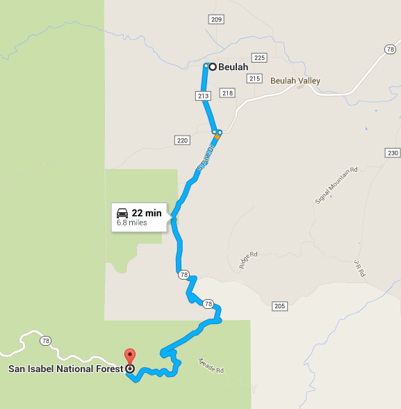
freecampsites.net 12 Mile Road - Beulah, Colorado
- 12 Mile Road
- This is a FREE campsite.
- 8831-8833 Colorado Hwy 78 Beulah, Colorado
- GPS: 38.01635, -105.007156
- maps.google.com 12 Mile Road - Beulah, Colorado
- Public - Forest Service (USDA) (Unofficial)
- The road in is Dirt and aprox. 5 miles from a paved road.
Small loop of sites in San Isabel Nat. Forest just off of 12 Mile Rd./ Hwy 78 between Beulah & San Isabel (CO Hwy. 165)in a small meadow surrounded by forest, with some sites farther back from the road in the trees. 12 Mile has occasional traffic, but over all, very quiet. Another small meadow with trailhead just across the road (San Carlos or St. Charles, don’t remember which. I marked it hiking and horse only because I don’t remember whether bikes and/or ATVs are allowed.)
Editors Note: This dispersed camping area is located in the San Carlos Ranger District of the San Isabel National Forest. It is first come, first served – no reservations. It is not an official campground so there are no facilities nor is it maintained. Hwy 78 is a maintained, wide, and dirt road (check it out in google street view). If you have specific questions, you should contact the ranger district. So that they know where you are talking about, I would ask them about “the dispersed camping area on hwy right across the road from the San Carlos Trailhead.” Here is their contact information:
San Carlos District
        3028 East Main Street
        Canon City, CO 81212
        Phone (719) 269-8500
freecampsites.net Truck Stop Parking Lot
- This is a FREE campsite.
- Tomahawk Truck Stop Parking Lot
- 12080 Sable Blvd, Brighton, CO 80601
- GPS: 39.915684, -104.817558
- maps.google.com Truck Stop Parking Lot
freecampsites.net Temple Canyon Park - Cañon City, Colorado
- Temple Canyon Park
- This is a FREE campsite.
- Temple Canyon Road/CR-3
- Cañon City, Colorado
- GPS: 38.405869, -105.319
- Public - City Park (Official)
- (719) 269-9028
- The road in is Dirt. You may stay 72hrs at Temple Canyon Park
- maps.google.com Temple Canyon Park - Cañon City, Colorado
- coloradoguy.com Temple Canyon Park - Cañon City, Colorado
Free camping near Grape Creek. It is about 6 miles south of Canon City. Two designated campgrounds. Dirt road with a “Limited Maintenance” sign but usually passable in a a passenger car. A rustic, out of the way place. No water or trash services are provided. Bring what you need, take what you bring. CR-3/Temple Caynon Road eventually ends up at the entrance to the South Rim of the Royal Gorge Park near Parkdale.
Directions: From the west end of Canon City on Highway 50, go south on First street for one mile. Keep to the right on County Road 3 which becomes Temple Canyon Road - follow the signs to Temple Canyon Park.
South Dakota
freecampsites.net Griffin Park - Pierre, South Dakota
- Griffin Park
- This is a FREE campsite.
- Pierre, South Dakota
- GPS: 44.359206, -100.345902
- Public - City Park (Official)
- (605) 773-7437
- maps.google.com Griffin Park - Pierre, South Dakota
The road in is Paved. Griffin Park is open Year Round. There are 16-29 campsites at this location and the maximum RV length is unlimited. You may stay 5 at Griffin Park.
RV sites
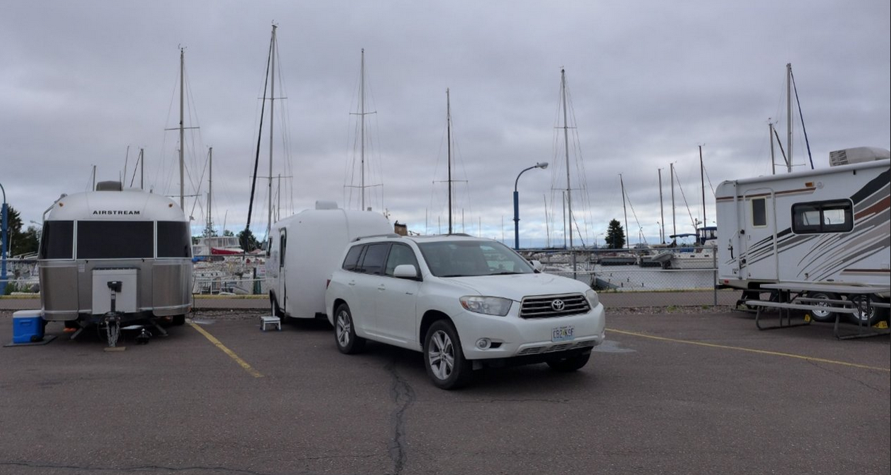
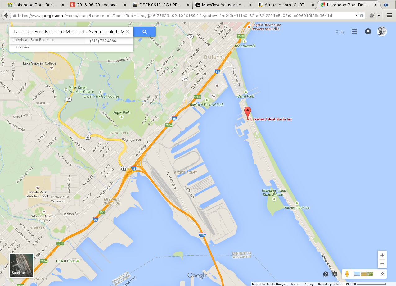
fiberglassrv.com/forums Lakehead Boat Basin, Duluth, MN
Ms. Gayle - Last week I spent a night at Lakehead Boat Basin in Duluth, MN. I was overnighting and had read about this very small (18 sites) RV option. It is located 3 blocks from Canal Park (waterfront shopping, restaurants, museum, etc). For me the RV option was fine. You are right in the marina watching boats go by while the aerial bridge goes up and down.
maps.google.com Lakehead Boat Basin Inc 940 Minnesota Ave Duluth, MN 55802
fiberglassrv.com/forums Missouri’s Ozark National Scenic Riverways
Missouri Mark - Missouri’s Ozark National Scenic Riverways
In appreciation for all the advice and knowledge I have learned since discovering Fiberglass RV forum, I will offer my recommendations for anyone who finds themselves passing thru Missouri in the future and looking to camp in scenic surroundings…
Most will travel I 44 or I 70 going west or east, or I 55 heading north or south, passing thru Missouri. Stretching across the entire length of southern Missouri is US Hwy 60, a much improved, nice 4 lane highway, that travels across the Ozark Mountains. There are an abundance of camping opportunities on Missouri’s Ozark National Scenic Riverways, which include the Current River, the Jack’s Fork River, a the Eleven Point River. Developed campgrounds with electric and water exist at Round Springs, Alley Springs, and Big Springs. Undeveloped campgrounds can be found at the numerous access points to the rivers. Clean spring fed streams that run thru deep valleys is the wilderness you can expect.
Many places you can pull your camper close to the water’s edge. Most CG will have vault toilets and running water. But those wanting to get off the beaten path, check with the numerous Department of Conservation offices located along Hwy 60 on where to camp. Lots of beautiful places to camp within 20 miles of the Hwy 60 corridor that will offer great scenery, solitude, fishing, hiking, campfires, and cheap float trips with several canoe rental places that operate year round with some advance notice in the winter months, a phone call will be enough to have someone take care of you.
Thank God that the people of southern Missouri stood up in the ’40s and ’50s and demanded that these streams would always remain in their pristine conditions. If you haven’t experienced the Missouri Ozarks, give yourself a treat and spend a few days camping on one of our streams.
And you will most likely always find yourself within a 20 minute drive to a small town for supplies if needed.
Anyone interested in some ideal spots for boondocking, send me a message.
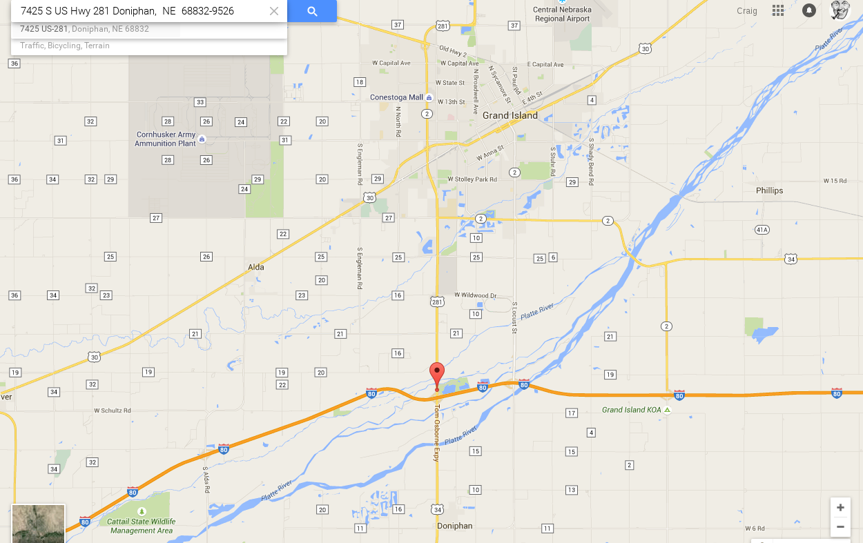
outdoornebraska.ne.gov/parks Mormon Island SRA, Grand Island NE
Contact Information:
        Mormon Island SRA
        7425 S US Hwy 281
        Doniphan,  NE  68832-9526
        Phone: (308) 385-6211
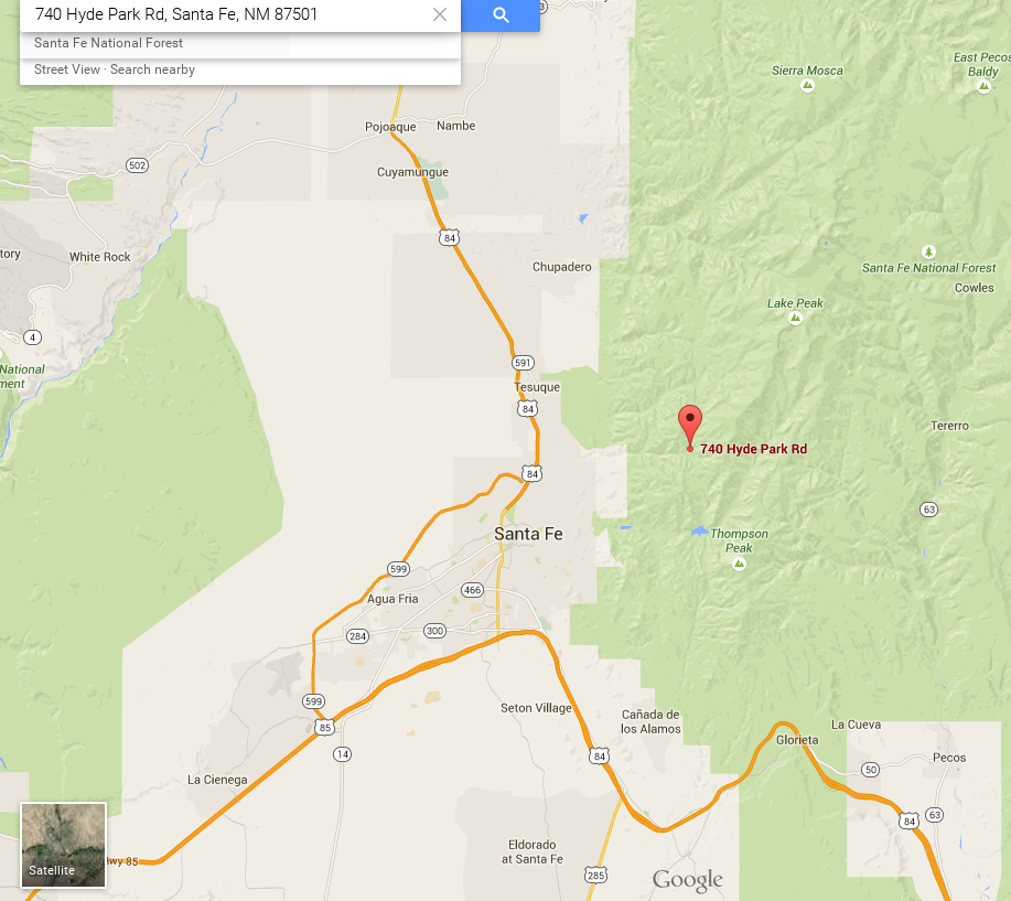
Hyde Memorial State Park - New Mexico
NM state park Hyde Memorial State Park - New Mexico
New Mexico’s first State Park is set in the Sangre de Cristo Mountains amongst a forest of pines along Little Tesuque Creek. The park is a short drive from Santa Fe and offers excellent group facilities and campsites. There are beautiful hiking trails with spectacular views. You can enjoy Hyde Memorial State Park in the winter months too with snowshoeing, sledding and cross-country skiing. The historic Lodge is the perfect location for your next family reunion, wedding or other event.
Park Elevation 8,300 - 9,400 ft